I've got an Excel tool from this forum for resizing an image using a square grid, but i'm stumped when it comes to resizing one for a hex map. I"ve tried adjusting the grid in Maptool, as well as guess-timating resizes in Paint.net, but got nowhere. It appears that the image's pixel count per hex is somewhere inbetween 21 and 22, cause neither of those setting match up with the image's grid.
Can i attach the image so someone can tell me what i'm doing wrong? it's 1.3 meg.
Resizing a Hex grid map
Moderators: dorpond, trevor, Azhrei
Forum rules
PLEASE don't post images of your entire desktop, attach entire campaign files when only a single file is needed, or generally act in some other anti-social behavior.
PLEASE don't post images of your entire desktop, attach entire campaign files when only a single file is needed, or generally act in some other anti-social behavior.

Re: Resizing a Hex grid map
If the image size is to large to attach, just attach a portion of it.
I guess I'm not understanding what you want to do. Your Excel sheet gives the information for resizing a single JPEG/PNG image that has a square grid so that it fits a particular pixel resolution, is that right?
And now you want a similar sheet to do the same thing for a hex grid? You could also try attaching the Excel sheet for the square grid so people could open it and see what you're talking about (if they were able to help at all).
Why not just drop the image into MapTool and then resize MapTool's grid so that it lines up with the image? Then you can leave the image alone entirely...
Re: Resizing a Hex grid map
Yes, I tried resizing the grid in Maptool already. A grid size of 21 is too small, and 22 is too big. So the image needs to be resized instead, but how do you know how much to resize an image using a hex grid?
There's a calculator in this forum for images with square grids, but I'm not sure how those calculations would translate for a hex grid. Here's a blog with a link to the calculator: http://www.beauvais1.com/mapscaletool/
The big drawback to this calculator is that you have to enter the number of grid units in height and width, which can be very difficult to count on large maps without printing them out.
And i was wrong about the image size. It's only 303 kb. Is that too large to attach?
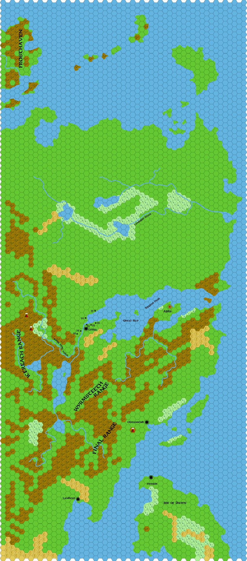
Thanks so much for your help. The image is an old school hex map of Norwold. Someday, I'd like to run the big mass combat scenario from Test of the Warlords, but the only other thing stopping me, other than time, is getting this grid to align.
There's a calculator in this forum for images with square grids, but I'm not sure how those calculations would translate for a hex grid. Here's a blog with a link to the calculator: http://www.beauvais1.com/mapscaletool/
The big drawback to this calculator is that you have to enter the number of grid units in height and width, which can be very difficult to count on large maps without printing them out.
And i was wrong about the image size. It's only 303 kb. Is that too large to attach?
Thanks so much for your help. The image is an old school hex map of Norwold. Someday, I'd like to run the big mass combat scenario from Test of the Warlords, but the only other thing stopping me, other than time, is getting this grid to align.
Re: Resizing a Hex grid map
if someone can offer some help with getting this image resized to fit maptool's hex grid, i'd be much appreciative ...
I"ve attached the image.
I"ve attached the image.
- Attachments
-
- cm1-m2-norwold-24.png (303.82 KiB) Viewed 1900 times

Re: Resizing a Hex grid map
I managed to do it with a perfect fit at grid size 22. The map has to be enlarged 101,63%.
It was just a matter of carefully approaching the sweet spot from both sides, so to speak.
I strongly recommend deleting the grid from the image if you can and just using the MT one, because the resizing has caused some not-so-subtle artifacts.
It was just a matter of carefully approaching the sweet spot from both sides, so to speak.
I strongly recommend deleting the grid from the image if you can and just using the MT one, because the resizing has caused some not-so-subtle artifacts.
Spoiler
Re: Resizing a Hex grid map
This is so awesome. Thank you very very much for the effort!
-
Sol Invictus

- Cave Troll
- Posts: 95
- Joined: Fri Oct 21, 2011 12:48 pm
- Location: Jena/Thuringia/Germany
Re: Resizing a Hex grid map
I use the mentioned MapScaleTool as well. And it should probably work with hex maps the exact same way, since hexes also have a 1:1 width:height ratio.
To count pixels on an image, you do NOT have to count each pixel yourself. If you use e.g. IrfanView, you can just select an area on the image by rubber band, just like selecting files on your desktop. IrfanView then displays the dimensions of the selection in the window heading, next to the file name. You can adjust the selected area by moving the borders of the selection. Zooming in/out with CTRL + mouse wheel (for that purpose) does not change the selection.
To count pixels on an image, you do NOT have to count each pixel yourself. If you use e.g. IrfanView, you can just select an area on the image by rubber band, just like selecting files on your desktop. IrfanView then displays the dimensions of the selection in the window heading, next to the file name. You can adjust the selected area by moving the borders of the selection. Zooming in/out with CTRL + mouse wheel (for that purpose) does not change the selection.