
Want help? Check out the #map-elevation Discord channel!
Please view the Video Introduction:
Seeing it in action is SO much better than reading about it!
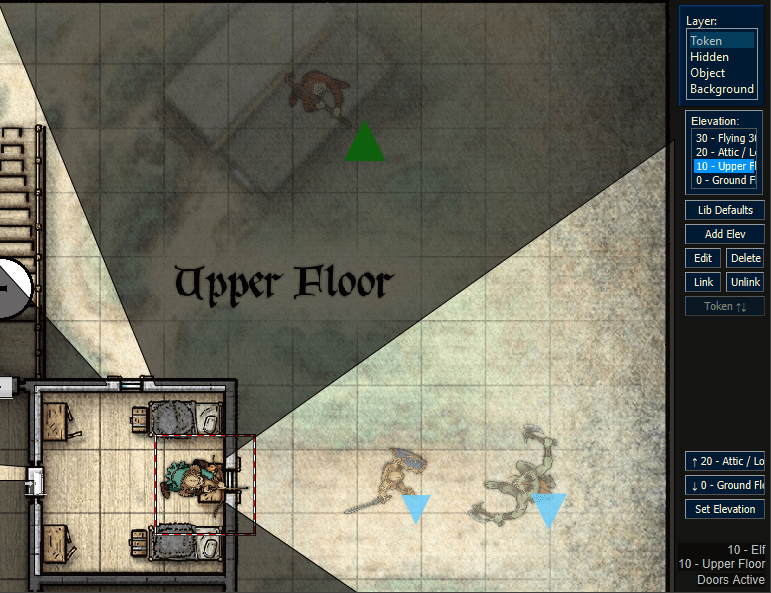
This is a tool to create vertical maps, enable flying, multi-story maps, and other elevation- and blocking-layer-related tricks in MapTool. I'm really proud of this tool. Using it with my group resulted in a smooth experience where NPCs remained on different levels of a multi-story building while characters could see where they were vertically in relation to each other.
Embedded UI style with dynamic, theme-sensitive color scheming!
GitHub Release: https://github.com/melek/lib_elevation/releases
Wiki Documentation: https://wiki.rptools.info/index.php/Lib ... ion_Manual
Please visit the GitHub release page to download the alpha release. Play with it, explore it and ask questions before filing issues, there is a lot in the library. I'll be expecting to use mainly the discord #map-drawing-tools and #vbl-mbl-fow-discussions to discuss this tool, though here on the forum is of course welcome also.
I strongly recommend diving into the demo campaign and dragging the colored GM macros to your GM Panel to try things out. The tooltips should help, and the documentation will hopefully assist. All of the built-in functions have tooltips and start with elevation., so in the macro editor you can use the CTRL-Space auto-complete feature to view all the functions. Some have further comments in the macros (and most function macros can be clicked directly as well) if you toggle them to be visible with the Safe/DIY mode button.
If you have questions not covered by the tooltips or by the documentation, you can ask here or on Discord in the #map-drawing-tools channel. You can also file an issue on GitHub.
Enjoy!
Nothing to see here
- MapTool Video Thumbnail Compressed.jpg (56.25 KiB) Viewed 7047 times

