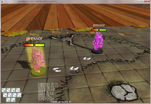
revinor wrote:Quick prototype (one of the left has cursor over it, so it has 'hover over' effect).
I have made them to always face the camera - in other case, they look very strange from the side (in real life, you have stereo vision, so you always see something, here it is possible to just get thin line/nothing). Still of course, if you look from very top, you will get nothing...
Looks very nice.
Yes, tile-resolution for FoV would mean that entire square (tile) would be visible or not visible, instead of exact field of view as done by MapTool.
Ok, that's what I was thinking, but I wanted to make sure it wasn't connected to something like "map tiles". Seems like it would be be a useable solution. 4E people might not even dislike it as everything is "blocky" for them.
On the other hand, when I think about it, as long as I would assume that map is flat for the needs of FoV, I could probably directly reuse maptool logic, draw the resulting 'fog' area on texture and apply the texture as kind of decal on the map.
That would be the coolest implementation and would work fine in a 2d map world.
Out of curiosity, how hard would it be to place other 2d "layers" on top of the main you currently have with your current implementation so that you had virtual map layers? I've been recently working on a map in MT of a manor where there is a huge chunk on the second floor that's cut out and allows for the area below to be seen (balcony type area circumventing a banquet hall and gardens.) In MT, I faked a blurry copy of the map below in the cutout, but it's obviously not a view of what's actually below.
If the layer a token was actually on was always the floor (with regard to zoom) for players, it seems like it would be kind of cool that they could still see what was below them in some fashion through cut out areas (though it might need to be slightly darkened or blurred.) This would also work well with rooftops, etc.
On the GM side, you could allow them to zoom through layers or maybe just hide layers so that they couldn't see them all at once if it was unmanageable. Still, being able to zoom out and see the entire layer structure in 3d would be totally workable for smaller maps.
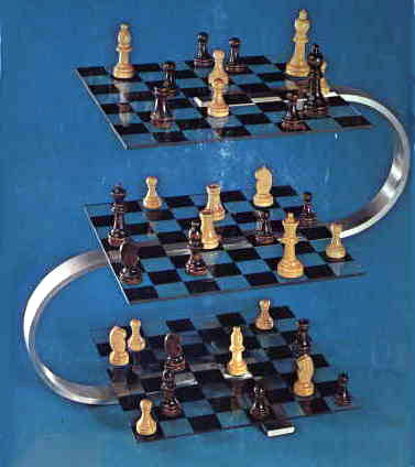
Planar 3d games like 3d chess would be possible too...